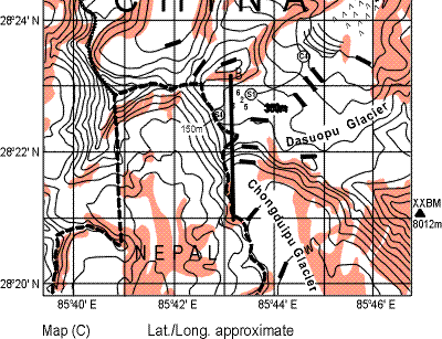
Google Earth really has some marvellous images. At the AGU convention, there were a number of exhibits showing sophisticated applications. I haven’t figured out any sophisticated applications, but I’ve enjoyed locating some of the sites discussed here on Google Earth. Today I’ve located the Dasuopu glacier and compared Google Earth to a sketch from Thompson’s website. Here is a blow-up of a diagram at Thompson’s website. S4 and S1 appear to be the summit and Core 1 locations.
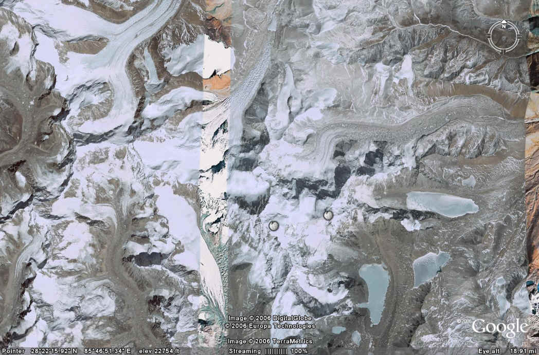
Now here is the corresponding figure from Google Earth. The Chongdulipu glacier is easy to see in both the map and satellite image. The geological formations – moraines, moraine-dammed proglacial lakes, glacier flow – are all very visible.

Three ice cores were recovered, the first of which was drilled down-flow from the ice divide but did not reach bedrock. The time series extends back only to 1922 A.D. at 160 m, and below 74 m depth (corresponding to 1945 A.D.) the stratigraphy is severely compromised by ice flow.
http://www.climateaudit.org/?p=969


