After a couple of bitchy posts about Ritson and Huybers, I’d like to do something a little more cheerful. Here’s some information that I’ve collected about Timber Gap Upper (ca529) and Timber Gap Lower (ca532), two Graybill foxtail pine sites that were important components of the MBH98 PC1 and have been used elsewhere. I’ve identified what seems to be this very location on a 19th century map to a former mining town (now a tourist town), Mineral King, California. I’ve found some very pretty pictures of the area and some interesting history.
First, here are two pictures from dendro people which are said to be of Timber Gap:
 |
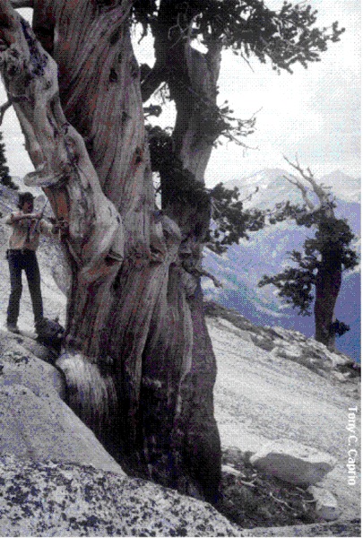 |
Figure 1. Timber Gap Foxtails. Left – Bogan http://essp.csumb.edu/capstone/proposals/images/bogan/bogan6.jpg; Right – Grissino-Mayer http://web.utk.edu/~grissino/images/foxtail.gif (Photographer – Tony Caprio)
The location for Timber Gap in Graybill is given as 3627N, 11837W, elevations Upper – 3627m (11,900′) and Lower – 3017m (9900′) respectively. To locate historical information on bristlecone sites, I’ve found it helpful to try to locate nearby abandoned mining sites. Many towns in the American West originated as mining towns (Park City, Aspen, Vail) and, in the 19th century, there were many little towns and mining camps that have been abandoned. A useful California gazetteer for names of such sites is http://www.calsign.com/mining/cowintro.htm. When I checked today, some of the URLs that I looked up earlier in the year were disabled and I could not exactly replicate some informaiton, which I fortunately recorded.
My earlier search identified a Timber Gap at 362806N 1183550W, which is certainly close to the Graybill site (and possibly the same site allowing for some uncertainty in both location references). I looked for the nearest 19th century mining town and located Mineral King, identified in the gazetteer at 362703N 1183538W 2387 m ( 7830 ft)]. This is clearly on the same E-W road and just a little bit to the east of Graybill’s Timber Gap. Mineral King is in Tulare County, but is accessed from Fresno County in the west due to the height of land. Mineral King has long ceased any mining operations, but still exists as a tourist location. Some of these old mining camps have interesting web-accessible information and this was the case here, starting from here.
Of particular interest is the map shown below, originally from here:

Figure 2. Historical Map from Mineral King Website
You can see Mineral King located on the map (at 8100 feet, rather than 7830 feet per the gazzetteer: the information in the map here would presumably be more reliable.) A “Timber Gap” is shown on the map, a little to the north. You will see a location for a sawmill (Attwell’s Sawmill) in the above map. Ghosttowns. com says here:
Atwood Mill and Mineral King were lumber and mining towns. Atwood Mill was named after a mill of the same name. Unfortunately, Atwood Mill’s location left much to be desired and it was constantly threatened by avalanches. Eventually, the town succumbed to one and was no more.
There are some wonderful pictures and 19th century records at the Mineral King website . Here’s an extended quote:
To make certain a good supply route to the mines was ready for the summer, a new trail rather than a road was cut from Red Hill’s summit. It ran ten miles up the south side of the East Fork to a point across from Cold Springs below Look-out Point. There it crossed the canyon to the north side and eventually joined the old Lovelace trail into the Mineral King valley. It wasn’t until five years later that a wagon road was completed into the valley by the Mineral King Wagon and Toll Road Company. This road abandoned the trail route on the south side of the canyon. It followed the original New England cut down to the river from Red Hill Summit at what is now Bear Ranch instead. From there it started up the north side of the canyon. The River Hill grade climbed to Cain’s Flat and finally joined the trail route near Look-out Point.
The entire road seemed to be in as much of a hurry to reach the mines as were the builders who constructed it. The hard pull began at the bottom of Red Hill.
“Beyond the Hammond Power House, it turned east, and the steep, hard grades prevailed meaning real work for the team,” Eugene Allen reminisced in later years. “Today as the road passes the Hammond Fire Station, it switches back and forth on mostly a high gear grade to the top of Red Hill. In 1911, it took a short cut almost straight up a draw until it reached the summit of Old Red Hill.”
In summer, the Red Hill climb up the “Devil’s Backbone” could be an unpleasant introduction to Mineral King road travel.
“We began our climb up Red Hill, a climb we were not anticipating with pleasure,” Alice Crowley recalled of an early stage coach trip. “The soil was brickish-red in color, and the loose dirt on top lay deep. We were driving in the heat of the early afternoon sun. The team had to stop often to rest. Each time it did, the stage and its occupants were enveloped in a thick cloud of red dust that made us cough and sneeze.”
Red Hill was a place to get over and beyond, not a place to stay. Yet Captain Dorst and his cavalry found themselves camped there in the spring of 1891. Dispatched from their post in San Francisco to patrol the back country of newly formed Sequoia National Park, Dorst learned their most logical summer base would be outside the park, in the Mineral King Valley at the end of the only road into the high country.
Unfortunately for the troop, 1891 was a wet year and Dorst found himself, his 58 men, 60 horses and 20 mules unable to reach the mountain valley. On their arrival at the park’s boundaries in May, camp was made at the base of Red Hill. From there his soldiers worked with the county to repair washouts and dig through snow drifts to reach the valley in late June.
For over a week in late May, Dorst found himself caught at the Red Hill summit camp waiting with half the freight to get it hauled up the steep road to Cain’s Flat on the other side of the river. It as not a pleasant camp site. The weather was comfortable in the eighties, the river provided some fishing, but Dorst found little to his liking. On May 23rd, he sat at a desk under a tree in the open air and wrote to his wife about his feelings.
“I find it is very hard now not to feel lonesome. . . It is the first time I ever wanted to go back into a post after getting into the field. . . You may be sure I want to get away from here, as citizens are constantly dropping in, eating my grub and asking questions for my decision. Troops are a curiosity in this country and everyone wants to see ‘the boys’.”
The military camp at Red HIll was used throughout the early military administration of the park as a fall and spring base camp for the Mineral King road. In 1915 the steep pull up Red Hill was turned into a series of pleasantly winding curves to its summit. From there, a new road followed the old pack trail line to a bridge that was constructed across the deep canyon below Oak Grove.

Here’s a fine modern picture of Endurance Hill from the Mineral King website here
The Mineral King road remained in county hands until portions of it became part of Sequoia National Park in 1890. However, its entire length was maintained by the county for over 50 years. After Mineral King was included in Sequoia National Park in 1978, the National Park Service took over full management of the roadway from the park boundary below Lookout Point into the Mineral King Valley.
There are also references to Timber Gap in hiking itineraries in the Mineral King area. It’s hard to say from here whether exactly the same sites are involved; it’s possible that the name “Timber Gap” might be a little bit generic, like “Deer Lake”. If the sites are not the same, they seem to be very nearby.
Another reference to Timber Gap in the area of Mineral King occurs in a hiking webpage here
Timber Gap: This trail follows an old mining route along Monarch Creek before branching off from the trail to Monarch and Crystal Lakes. The open slopes surrounding the Mineral King Valley are kept free of trees by avalanches; Timber Gap itself is protected from avalanches, and is covered with red fir which the miners in the 1800’s used for fuel and to shore up their mine shafts. From Timber Gap, you can see north to the Middle Fork of the Kaweah River and across to Alta Peak. The hike to Timber Gap is 2 miles one-way.
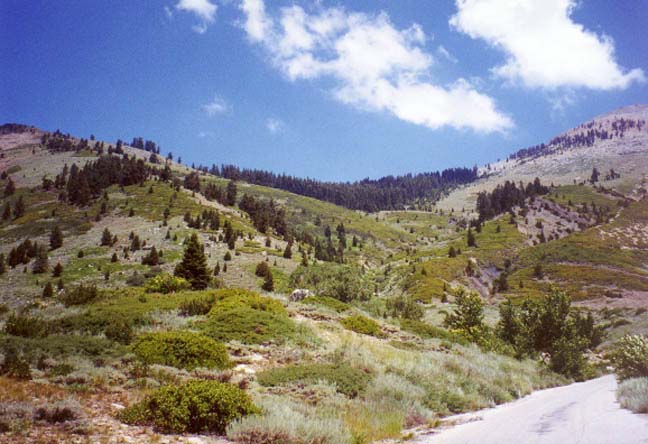
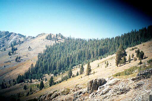
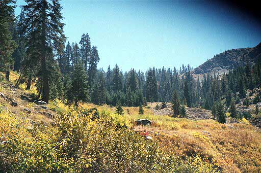
Another local hiking photo-gallery has some nice picture of Timber Gap on a trail near Mineral King.
 |
 |
 |


6 Comments
Does this article have a climatological point or is it just for scenic interest?
Among other things, it delightfully illustrates using the web to locate a variety of kinds of information.
I’ve tried to collect information on bristlecones of any sort to see whether there were any non-homogeneities in the 19th/20th century. I’ve tried to keep other alternatives besides CO2 fertilization open.
It is a well-known dendro effect that logging creates a “release” for remaining trees. Dendro people say in an arm-waving way that nobody would take timber from bristlecone sites. I haven’t seen any direct references to any timber activity at this site, but the name Timber Gap is suggestive of some connection to timber. Looking at the pictures, the timber was probably taken from the lower trees but I’ve seen some evidence of timber being taken from high bristlecone sites for little mines (I’ll show this in my next post on this topic).
Could this road have opened up acess to alpine meadows for sheep? Of course it could.
I think that you have to canvass these things. But, even if nothing turns up, the sites are pretty and I hated to waste the work.
RE: CO2 fertilization. From the melt, there is moisture which waters the seasonal grasses. In all but the highest meadows, with the exceptions of years with a strong enough Monsoon / convective summer showers, the grass dies off by mid to late summer. In years with an El Nino, the snow pack would tend to be massive early on but then get melted off by late rains with a high snow level (e.g. the Pineapple Express pattern). In such years I would expect the grass to grow much more prolifically.
If a year starts out with a Siberian Express (north to south jet stream) and then there is a spring drought, the effect might be similar.
In either case, it ends up as a thicker detritus layer than other years, and on to fertilize the trees. Anyone who assumes that Bristlecones or Foxtails grow more with warmer temps, per se, may not understand all the factors involved in their growth.
The image you posted of the foxtail pine being cored (top right) is a copyrighted image. As the photographer I’m asking that you please remove the image from your page since you did not obtain permission for its use although it explicidely states on the source page (http://web.utk.edu/~grissino/gallery.htm) that permission needs to be obtained (Grissino-Mayer was not the photographer):
(“A word of warning: all photographs are copyrighted material. If you wish to use any graphic on any of your web pages, slide presentations, or in any published material, you should first contact the individual to determine the conditions of use. You should expect to credit the photographer next to the photograph.” – Grissino-Mayer http://web.utk.edu/~grissino/gallery.htm#Copyright).
Additionally, you purposely cropped the original image to remove the credit that was part of the image (http://web.utk.edu/~grissino/images/foxtail.gif).
Tony Caprio
bump – in response to Louis’ comment about minerals in the other thread, here’s an example where the access to the trees is from a road to a ghost 19th century mining site and the name Timber Gap has survived from 19th century usage.